Phuket International Airport (HKT)
Driving Directions / Travel by Car
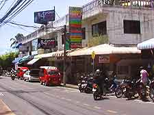
(Phuket, Thailand)
Located at the northern end of Phuket Island, the Phuket International Airport (HKT) is just off the south-west coast of Thailand. The closest town to the airport is Phuket Town, which is 32 km / 19 miles away or a 45-minute drive from the airport.
Phuket Island is linked to the mainland at its northern tip by the Sarasin Bridge, and there are also regular ferries to the island.
Directions to Phuket International Airport (HKT) from the north:
- From the north, join Highway 4 and follow it south to Khok Kloi
- Take the 402 road towards Tha Chat Chai and Sarasin Bridge
- Cross the bridge and follow the 402 for approximately 12 km / 7 miles
- The airport is signposted from the 402
Directions to Phuket International Airport (HKT) from the east:
- Follow highways 415, 4035 and 4037 until they join highway 4
- Turn north on Highway 4 and follow it until you reach Khok Kloi
- Join Highway 402 and head to Tha Chat Chai and Sarasin Bridge
- Cross the bridge and continue for approximately 12 km / 7 miles
- The airport is situated on the rights and is well signposted from the 402
Directions to Phuket International Airport (HKT) from the south:
- Coming from the south, follow Highway 4 north until you reach Khok Kloi
- Join Highway 402 and head for Tha Chat Chai and Sarasin Bridge
- Cross the bridge and continue for approximately 12 km / 7 miles
- Turn right off the 402 when you see signs for the airport
Directions to Phuket International Airport (HKT) from the west:
- Phuket International Airport lies on the western coast of Thailand and therefore cannot be approached from the west by road
Traffic congestion on Phuket Island occurs during the high season and at rush hours, while the beach resorts are generally free from traffic delays.
